 |
 |
Coverage :
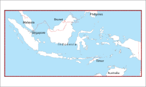
Indonesia and surrounding countries |
|
Information :
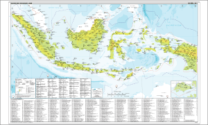
Indoavis Nusantara International Flight Support maintains a lot of data on airports around the world, including the international airport there is information code (ICAO / IATA). You can now take the airport location information stored in the map. These maps are very useful for planning to fly across the country and inter-country traffic.
Indonesia index Airport Chart is a map of the spread of the airports in Indonesia and surrounding countries, there are nearly approximately 500 airports are mapped. |
|
Aeronautical :
Airport position, City, Airport management, ICAO/IATA Code, Rwy PCN, Length of longest, Type of Airport and Radio comm |
Topograpichal :
|
Doc. Reference :
AIP (Aeronautical Information Publication) |
Remarks :
The map scale 1:5.000.000 (1: 27Nm) and the size of paper 100 x 63 cm. |
|