PAPUA INDEX PLANNING CHART
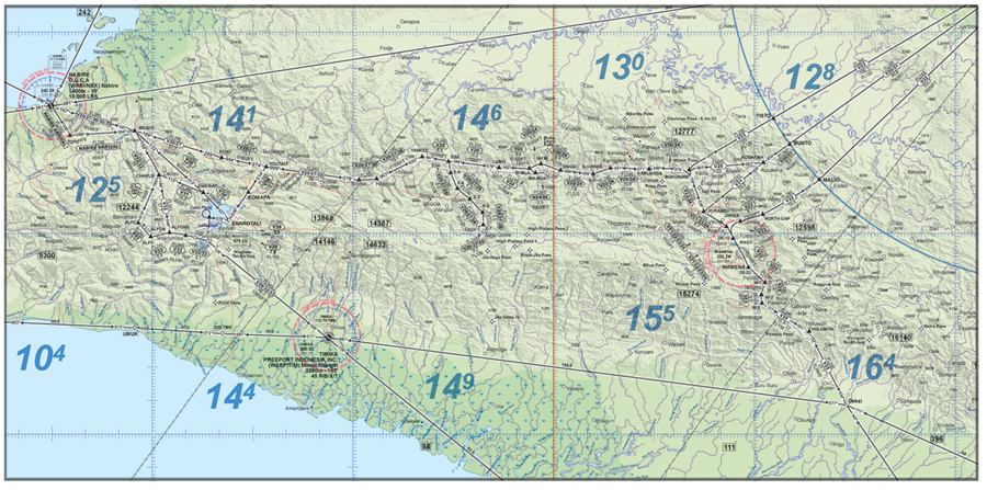
NAVIGATION & VFR ROUTE CHART
INDOAVIS NUSANTARA
ESTABLISHMENT OF VFR ROUTE WITHIN PAPUA AREAS
-
SCALE 1Cm = 6.6Nm / 1In : 16.8Nm
-
Effective Date : 02, February 2012
-
Paper size : 165 x 85 Cm
-
Chart Publish by : INDOAVIS NUSANTARA
-
Establishment of : AIP Supplement 06, 2011
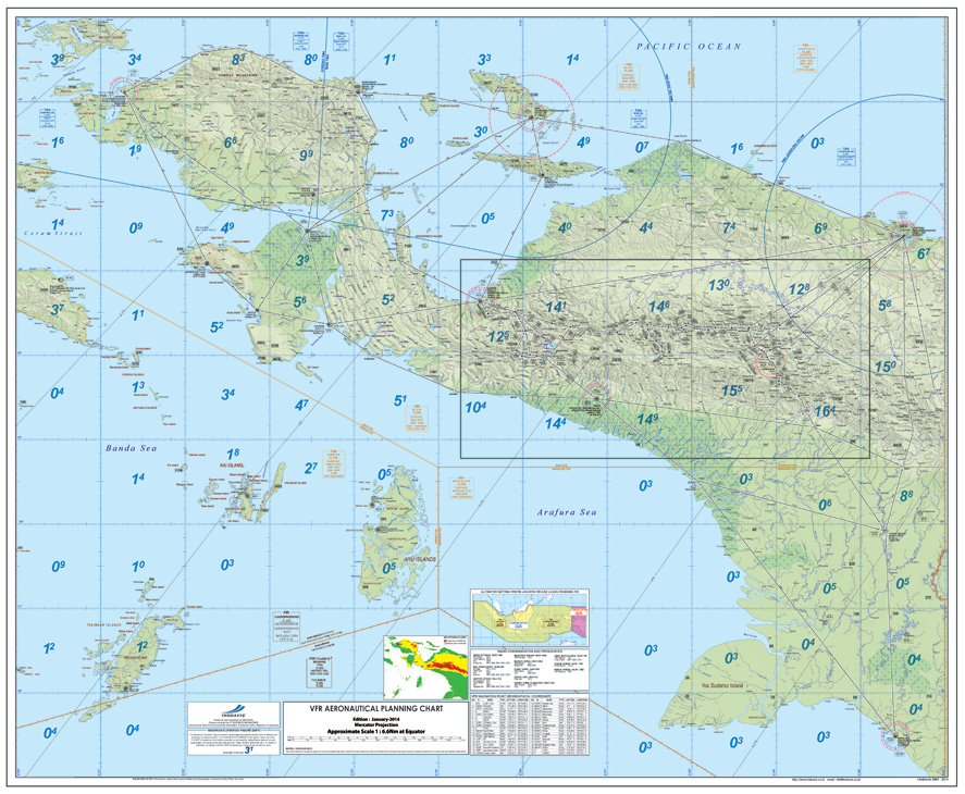
1. INTRODUCTION
With the increasing aviation traffic in the Papua area, which has a
geographical and climatologically characteristics that could endanger the
safety of flight, and then to support aviation safety and flight operations,
it is necessary to establish route VFR flight paths from and to the airport
as follows :
- Nabire – Jayapura (V20)
- Jayapura – Wamena (V21/V22)
- Wamena – Jayapura (V23)
- Wamena – Mulia (V24)
- Wamena – Dekai (V25)
- Mulia – Illaga (V26)
- Nabire - Yanke Area – Illaga (V27)
- Illaga – Enarotali (V28)
- Enarotali – Timika (V29)
- Nabire – Enarotali (V30/V31)
- Nabire – Timika (V32/V33)
To use VFR routes are necessary to comply with
requirements as follows:
- The aircraft must be equipped with a GPS TSO 129, 145 and 146
- Flight crew training about flying on that particular route
2. ROUTE SEGMENT
Details VFR Route Segment in Papua areas and chart relating to the segment
are depicted on the attachment “A1” to “A12” and attachment “B”.
3. IMPLEMENTATION
The implementation of this VFR Route will be in effect on October 20, 2011
at 00.00 UTC
4. CANCELLATION
Any changes of the information content on this AIP Supplement will be
notified through NOTAM or superseded by other AIP Supplement.
INFORMATION CONTENT
- CRUISING LEVELS INDONESIA FIRs
- A I R P O R T
- RADIO NAVIGATION AIDS
- TERRAIN / OBSTRUCTIONS
- VFR WAYPOINT
- AIRSPACE
- LOW ALTITUDE VFR ROUTE
- TOPOGRAPHIC INFORMATION
- HYDROGRAPHIC
- MAXIMUM ELEVATION FIGURE (MEF)
- RADIO COMMUNICATION AND FREQUENCIES
- VFR REPORTING POINT GEOGRAPHICAL COORDINATE
- AERODROME POINT GEOGRAPHICAL COORDINATE